2026 Society of Ethnobiology Annual Conference
May 20–23, 2026
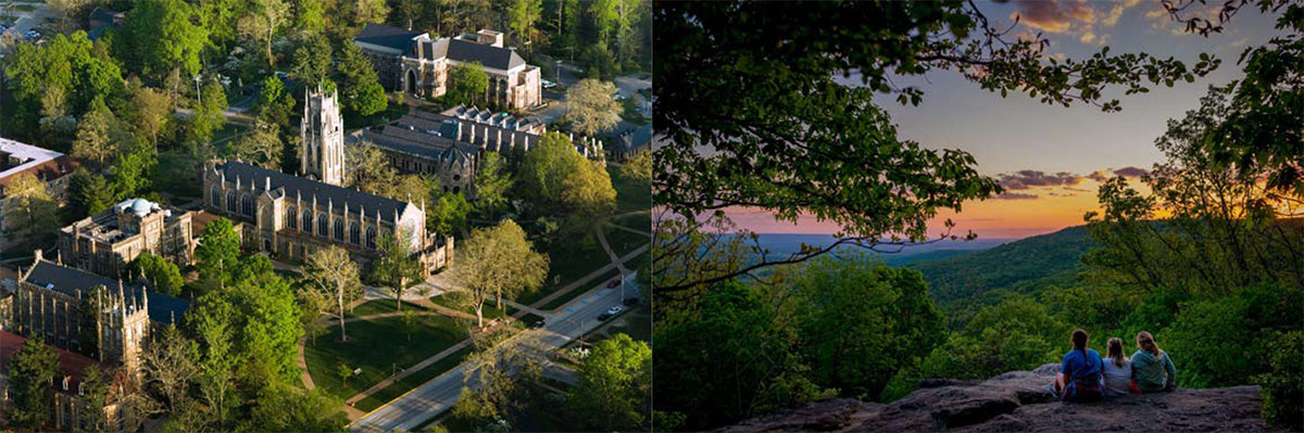
The University of the South, Sewanee, Tennessee
![]()
The 47th Annual Conference of the Society of Ethnobiology will be hosted at the University of the South, Sewanee, Tennessee, May 20–23, 2026.
The theme will be Biocultural Diversity of Waterscapes. As with all life, the interconnectedness of biological and cultural diversity is mediated through water. Waterscapes, fresh and saline, are the spatial manifestation of relations between humans, other animals and their shared environments. Watery places foster different dialectics in the co-evolution of biology and culture than landscapes. Sacred watery sites and their landscape contexts are places that inspire spiritual beliefs and practices that can help protect and maintain ecosystems, soil heterogeneity, and stocks of particular flora and fauna. Aquatic Sacred Natural Sites are vital nodes where community practices, identities and beliefs overlap with environmental stewardship. Ethnobiologies enshrined within water traditions and rituals have direct application for One Health initiatives and in planning for socioecological resilience around water security and the climate crisis.
Participants are welcomed to propose papers on any facet of Ethnobiology. Papers considering human engagement with watery flora, fauna or beings are encouraged, as are presentations considering waterscape Biocultural Diversity in relation to current ecological crises. Papers are especially invited that address how Local and Traditional Ecological Knowledge sustains ecosystems, biota of sacred places, and cultural identities related to water, wetlands, and watersheds.
Registration is NOW OPEN!
Located on the Cumberland Plateau, the rooftop of the Tennessee River Watershed, Sewanee's 13,000-acre campus was named the "most beautiful college campus in the U.S." by the 2026 Princeton Review. Sewanee is home to abundant and diverse fauna and flora across plateau wetlands and upland and cove forests, as well as waterfalls, that participants will be able to enjoy.
Links to more information:
Field Trips Transportation Dining
![]()